Rhone - Brig 2346
Discharge and Water level
|
Discharge
m³/s
|
Water level
m a.s.l.
|
|
|---|---|---|
|
Last reading
29.05.2026 20:00
|
85
|
666.26
|
| 24hr mean | 85 | 666.25 |
| 24hr maximum | 107 | 666.43 |
| 24hr minimum | 65 | 666.08 |
Danger levels
Discharge m³/s
- 5 > 570
- 4 460 - 570
- 3 380 - 460
- 2 250 - 380
- 1 < 250
Graphs
Regarding alerts, the statements as interpreted in the natural hazard bulletin on www.natural-hazards.ch are authoritative. The hydrological forecasts shown are direct model outputs. Explanatory notes on forecast plots
Data and statistics
Key figures Discharge
| Jan | Feb | Mar | Apr | May | Jun | Jul | Aug | Sep | Oct | Nov | Dec | |
|---|---|---|---|---|---|---|---|---|---|---|---|---|
| Monthly mean | 8.6 m³/s | 8.1 m³/s | 9.5 m³/s | 17 m³/s | 46 m³/s | 95 m³/s | 114 m³/s | 98 m³/s | 54 m³/s | 29 m³/s | 15 m³/s | 10 m³/s |
| Maximum reading |
66 m³/s
22.01.2020
|
68 m³/s
27.02.2020
|
99 m³/s
31.03.1981
|
125 m³/s
30.04.2018
|
348 m³/s
29.05.2008
|
589 m³/s
30.06.2024
|
426 m³/s
29.07.2013
|
493 m³/s
25.08.1987
|
457 m³/s
24.09.1993
|
557 m³/s
15.10.2000
|
252 m³/s
02.11.2004
|
85 m³/s
15.12.2000
|
| Minimum daily mean value |
4.4 m³/s
18.01.1970
|
4.1 m³/s
01.02.1970
|
4.2 m³/s
01.03.1970
|
5.7 m³/s
06.04.1975
|
5.6 m³/s
11.05.1982
|
19 m³/s
12.06.1974
|
28 m³/s
16.07.2000
|
22 m³/s
15.08.2006
|
11 m³/s
29.09.1996
|
7.4 m³/s
26.10.2003
|
6.1 m³/s
09.11.2003
|
4.4 m³/s
07.12.1997
|
Annual mean
Highest
57 m³/s
2024
Lowest
32 m³/s
2026
Mean
42 m³/s
Total period
Key figures Temperature
| Jan | Feb | Mar | Apr | May | Jun | Jul | Aug | Sep | Oct | Nov | Dec | |
|---|---|---|---|---|---|---|---|---|---|---|---|---|
| Monthly mean | 1.8 °C | 2.5 °C | 4.0 °C | 5.2 °C | 5.9 °C | 5.8 °C | 5.3 °C | 5.0 °C | 5.0 °C | 4.8 °C | 3.2 °C | 2.0 °C |
| Maximum reading |
4.6 °C
29.01.1988
|
5.1 °C
23.02.1989
|
7.8 °C
31.03.1985
|
9.2 °C
20.04.1985
|
10.0 °C
24.05.1987
|
10.9 °C
01.06.1984
|
9.9 °C
07.07.1984
|
9.6 °C
27.08.1988
|
9.1 °C
30.09.1984
|
8.5 °C
18.10.1988
|
7.2 °C
01.11.1989
|
5.7 °C
08.12.1982
|
| Minimum reading |
0.0 °C
18.01.1979
|
0.0 °C
04.02.1980
|
0.5 °C
10.03.1975
|
1.1 °C
27.04.1981
|
2.7 °C
05.05.1987
|
2.9 °C
22.06.1981
|
3.1 °C
27.07.1987
|
2.8 °C
25.08.1981
|
2.0 °C
23.09.1985
|
1.0 °C
15.10.1985
|
0.2 °C
30.11.1978
|
0.1 °C
09.12.1980
|
Annual mean
Highest
4.5 °C
1987
Lowest
3.5 °C
1976
Mean
4.2 °C
Total period
Station information
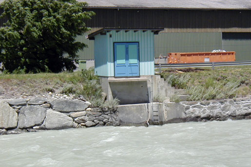
- Station altitude
- 667 m a.s.l.
- Catchment size
- 906 km2
- Mean catchment altitude
- 2339 m a.s.l.
- Glacial area
- 19.200%
- Station coordinates
- 2'641'347 / 1'129'701