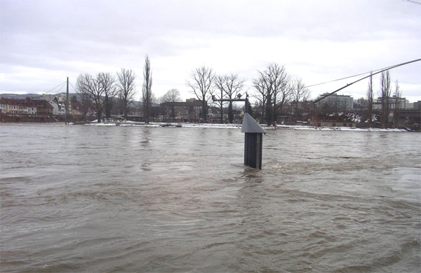
Rhein - Basel, Rheinhalle 2289
Discharge and Water level
|
Discharge
m³/s
|
Water level
m a.s.l.
|
|
|---|---|---|
|
Last reading
22.05.2026 08:10
|
699
|
245.28
|
| 24hr mean | 700 | 245.28 |
| 24hr maximum | 837 | 245.48 |
| 24hr minimum | 624 | 245.17 |
Danger levels
Discharge m³/s
- 5 > 4700
- 4 3700 - 4700
- 3 3050 - 3700
- 2 2550 - 3050
- 1 < 2550
Graphs
Regarding alerts, the statements as interpreted in the natural hazard bulletin on www.natural-hazards.ch are authoritative. The hydrological forecasts shown are direct model outputs. Explanatory notes on forecast plots
Data and statistics
Key figures Discharge
| Jan | Feb | Mar | Apr | May | Jun | Jul | Aug | Sep | Oct | Nov | Dec | |
|---|---|---|---|---|---|---|---|---|---|---|---|---|
| Monthly mean | 796 m³/s | 793 m³/s | 861 m³/s | 1038 m³/s | 1291 m³/s | 1525 m³/s | 1447 m³/s | 1245 m³/s | 1048 m³/s | 878 m³/s | 825 m³/s | 813 m³/s |
| Maximum reading |
3600 m³/s
25.01.1995
|
3889 m³/s
22.02.1999
|
3335 m³/s
25.03.1988
|
3457 m³/s
10.04.2006
|
5085 m³/s
13.05.1999
|
4300 m³/s
16.06.1910
|
3738 m³/s
15.07.2021
|
4810 m³/s
09.08.2007
|
3890 m³/s
22.09.1968
|
3250 m³/s
15.10.1981
|
3850 m³/s
23.11.1972
|
3857 m³/s
24.12.1918
|
| Minimum daily mean value |
292 m³/s
16.01.1894
|
285 m³/s
15.02.1891
|
272 m³/s
08.03.1909
|
357 m³/s
03.04.1921
|
465 m³/s
01.05.1921
|
653 m³/s
03.06.2020
|
553 m³/s
31.07.1949
|
461 m³/s
16.08.2022
|
399 m³/s
30.09.1895
|
349 m³/s
29.10.1947
|
337 m³/s
09.11.1947
|
316 m³/s
27.12.1920
|
Annual mean
Highest
1439 m³/s
1910
Lowest
606 m³/s
1921
Mean
1047 m³/s
Total period
Station information
- Station altitude
- 260 m a.s.l.
- Catchment size
- 35878 km2
- Mean catchment altitude
- 1052 m a.s.l.
- Glacial area
- 0.800%
- Station coordinates
- 2'613'389 / 1'267'678