Inn - Tarasp 2265
Information
Die aktuellen Daten können im Winter durch Vereisung der Anlage stark verfälscht sein.
Discharge and Water level
Temperature
|
Discharge
m³/s
|
Water level
m a.s.l.
|
Temperature
°C
|
|
|---|---|---|---|
|
Last reading
23.05.2026 21:10
|
26
|
1182.79
|
12.5
|
| 24hr mean | 19 | 1182.69 | 9.9 |
| 24hr maximum | 26 | 1182.79 | 13.0 |
| 24hr minimum | 18 | 1182.66 | 7.1 |
Danger levels
Discharge m³/s
- 5 > 410
- 4 340 - 410
- 3 280 - 340
- 2 190 - 280
- 1 < 190
Graphs
Regarding alerts, the statements as interpreted in the natural hazard bulletin on www.natural-hazards.ch are authoritative. The hydrological forecasts shown are direct model outputs. Explanatory notes on forecast plots
Data and statistics
Key figures Discharge
| Jan | Feb | Mar | Apr | May | Jun | Jul | Aug | Sep | Oct | Nov | Dec | |
|---|---|---|---|---|---|---|---|---|---|---|---|---|
| Monthly mean | 5.0 m³/s | 4.5 m³/s | 5.3 m³/s | 8.8 m³/s | 28 m³/s | 62 m³/s | 50 m³/s | 31 m³/s | 20 m³/s | 12 m³/s | 7.5 m³/s | 5.8 m³/s |
| Maximum reading |
23 m³/s
07.01.1970
|
16 m³/s
10.02.1970
|
62 m³/s
04.03.1970
|
110 m³/s
20.04.1971
|
243 m³/s
30.05.2008
|
297 m³/s
22.06.2024
|
441 m³/s
19.07.1987
|
372 m³/s
28.08.2023
|
352 m³/s
21.09.1999
|
233 m³/s
03.10.2020
|
116 m³/s
16.11.2002
|
62 m³/s
23.12.1991
|
| Minimum daily mean value |
2.8 m³/s
31.01.2005
|
2.7 m³/s
07.02.2005
|
2.7 m³/s
01.03.2005
|
3.6 m³/s
05.04.1996
|
5.8 m³/s
01.05.1972
|
14 m³/s
05.06.1976
|
14 m³/s
31.07.2007
|
12 m³/s
10.08.2005
|
7.6 m³/s
30.09.1972
|
4.7 m³/s
22.10.1972
|
4.0 m³/s
21.11.1971
|
2.9 m³/s
31.12.1985
|
Annual mean
Highest
36 m³/s
1970
Lowest
13 m³/s
2026
Mean
20 m³/s
Total period
Key figures Temperature
| Jan | Feb | Mar | Apr | May | Jun | Jul | Aug | Sep | Oct | Nov | Dec | |
|---|---|---|---|---|---|---|---|---|---|---|---|---|
| Monthly mean | 0.3 °C | 1.0 °C | 3.0 °C | 5.5 °C | 7.2 °C | 9.0 °C | 10.8 °C | 11.3 °C | 9.3 °C | 6.0 °C | 2.5 °C | 0.6 °C |
| Maximum reading |
3.1 °C
03.01.2023
|
5.0 °C
29.02.2024
|
7.4 °C
23.03.2023
|
11.1 °C
30.04.2025
|
13.0 °C
30.05.2025
|
16.3 °C
29.06.2025
|
16.8 °C
24.07.2022
|
16.6 °C
04.08.2022
|
14.1 °C
10.09.2023
|
10.7 °C
04.10.2023
|
7.2 °C
03.11.2020
|
3.6 °C
20.12.2019
|
| Minimum reading |
0.0 °C
01.01.2025
|
0.0 °C
03.02.2025
|
0.0 °C
01.03.2022
|
0.1 °C
05.04.2019
|
2.4 °C
07.05.2019
|
5.1 °C
01.06.2021
|
5.9 °C
16.07.2016
|
6.5 °C
08.08.2023
|
3.6 °C
26.09.2020
|
0.0 °C
28.10.2018
|
0.0 °C
19.11.2025
|
0.0 °C
13.12.2025
|
Annual mean
Highest
6.1 °C
2023
Lowest
5.0 °C
2026
Mean
5.6 °C
Total period
Station information
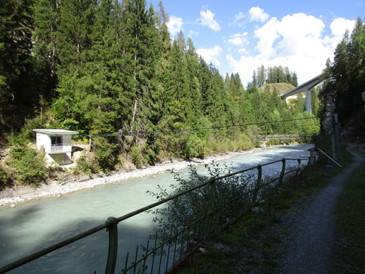
- Station altitude
- 1186 m a.s.l.
- Catchment size
- 1581 km2
- Mean catchment altitude
- 2384 m a.s.l.
- Glacial area
- 3.000%
- Station coordinates
- 2'816'820 / 1'185'921