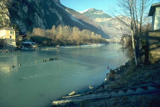
Rhône - Porte du Scex 2009
Discharge and Water level
Temperature
|
Discharge
m³/s
|
Water level
m a.s.l.
|
Temperature
°C
|
Oxygen
mg/l
|
Turbidity
NTU
|
|
|---|---|---|---|---|---|
|
Last reading
22.05.2026 23:00
|
170
|
375.38
|
12.4
|
10.9
|
37
|
| 24hr mean | 167 | 375.36 | 10.7 | 11.4 | 47 |
| 24hr maximum | 218 | 375.70 | 12.6 | 11.9 | 68 |
| 24hr minimum | 129 | 375.08 | 8.6 | 10.9 | 32 |
Danger levels
Discharge m³/s
- 5 > 1400
- 4 1200 - 1400
- 3 1000 - 1200
- 2 700 - 1000
- 1 < 700
Graphs
Regarding alerts, the statements as interpreted in the natural hazard bulletin on www.natural-hazards.ch are authoritative. The hydrological forecasts shown are direct model outputs. Explanatory notes on forecast plots
Data and statistics
Key figures Discharge
| Jan | Feb | Mar | Apr | May | Jun | Jul | Aug | Sep | Oct | Nov | Dec | |
|---|---|---|---|---|---|---|---|---|---|---|---|---|
| Monthly mean | 102 m³/s | 104 m³/s | 103 m³/s | 122 m³/s | 210 m³/s | 339 m³/s | 350 m³/s | 302 m³/s | 208 m³/s | 134 m³/s | 115 m³/s | 102 m³/s |
| Maximum reading |
403 m³/s
13.01.2004
|
520 m³/s
04.02.1970
|
474 m³/s
31.03.1981
|
451 m³/s
01.04.1981
|
816 m³/s
30.05.2008
|
1148 m³/s
30.06.2024
|
950 m³/s
01.07.1935
|
1004 m³/s
25.08.1987
|
1088 m³/s
25.09.1993
|
1363 m³/s
15.10.2000
|
930 m³/s
15.11.2023
|
546 m³/s
11.12.2023
|
| Minimum daily mean value |
37 m³/s
01.01.1990
|
34 m³/s
23.02.1942
|
37 m³/s
01.03.1942
|
45 m³/s
22.04.1973
|
50 m³/s
02.05.1938
|
98 m³/s
07.06.1976
|
134 m³/s
28.07.1976
|
103 m³/s
22.08.1976
|
67 m³/s
26.09.1976
|
56 m³/s
22.10.1989
|
50 m³/s
28.11.1943
|
36 m³/s
31.12.1989
|
Annual mean
Highest
241 m³/s
2024
Lowest
127 m³/s
2026
Mean
184 m³/s
Total period
Key figures Temperature
| Jan | Feb | Mar | Apr | May | Jun | Jul | Aug | Sep | Oct | Nov | Dec | |
|---|---|---|---|---|---|---|---|---|---|---|---|---|
| Monthly mean | 4.2 °C | 4.6 °C | 5.9 °C | 7.7 °C | 9.1 °C | 9.7 °C | 9.9 °C | 9.6 °C | 9.0 °C | 7.9 °C | 5.9 °C | 4.5 °C |
| Maximum reading |
7.6 °C
01.01.2023
|
7.7 °C
27.02.2021
|
10.6 °C
24.03.1996
|
13.5 °C
25.04.2011
|
13.2 °C
01.05.2011
|
14.0 °C
21.06.1998
|
14.1 °C
14.07.1996
|
13.0 °C
02.08.2011
|
12.9 °C
15.09.2019
|
12.4 °C
01.10.2017
|
10.0 °C
01.11.2022
|
7.7 °C
03.12.2001
|
| Minimum reading |
0.4 °C
03.01.1971
|
1.7 °C
10.02.1986
|
1.4 °C
07.03.1971
|
3.7 °C
17.04.2025
|
4.9 °C
05.05.1979
|
6.4 °C
01.06.2006
|
7.1 °C
22.07.1980
|
6.9 °C
27.08.1988
|
6.5 °C
13.09.1983
|
4.6 °C
31.10.1974
|
1.1 °C
22.11.1971
|
0.5 °C
03.12.1973
|
Annual mean
Highest
8.1 °C
2025
Lowest
6.7 °C
2026
Mean
7.4 °C
Total period
Station information
- Station altitude
- 380 m a.s.l.
- Catchment size
- 5238 km2
- Mean catchment altitude
- 2127 m a.s.l.
- Glacial area
- 11.000%
- Station coordinates
- 2'557'649 / 1'133'284