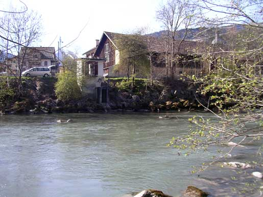
Vorderrhein - Ilanz 2033
Discharge and Water level
Temperature
|
Discharge
m³/s
|
Water level
m a.s.l.
|
Temperature
°C
|
|
|---|---|---|---|
|
Last reading
14.01.2026 06:50
|
3.4
|
690.59
|
0.7
|
| 24hr mean | 29 | 691.07 | 2.5 |
| 24hr maximum | 49 | 691.36 | 3.0 |
| 24hr minimum | 3.4 | 690.58 | 0.7 |
Danger levels
Discharge m³/s
- 5 > 770
- 4 640 - 770
- 3 520 - 640
- 2 300 - 520
- 1 < 300
Data and statistics
Key figures Discharge
| Jan | Feb | Mar | Apr | May | Jun | Jul | Aug | Sep | Oct | Nov | Dec | |
|---|---|---|---|---|---|---|---|---|---|---|---|---|
| Monthly mean | 16 m³/s | 16 m³/s | 18 m³/s | 24 m³/s | 48 m³/s | 68 m³/s | 58 m³/s | 41 m³/s | 34 m³/s | 27 m³/s | 22 m³/s | 17 m³/s |
| Maximum reading |
70 m³/s
16.01.1997
|
83 m³/s
28.02.2018
|
163 m³/s
31.03.1981
|
157 m³/s
30.04.2018
|
225 m³/s
19.05.1965
|
450 m³/s
15.06.2007
|
870 m³/s
18.07.1987
|
550 m³/s
07.08.1962
|
676 m³/s
07.09.2008
|
515 m³/s
03.10.2020
|
296 m³/s
16.11.2002
|
124 m³/s
22.12.1991
|
| Minimum daily mean value |
1.8 m³/s
20.01.1963
|
0.72 m³/s
24.02.1963
|
0.88 m³/s
03.03.1963
|
3.4 m³/s
02.04.1996
|
8.6 m³/s
01.05.1976
|
20 m³/s
06.06.1976
|
15 m³/s
25.07.1976
|
11 m³/s
22.08.1976
|
8.3 m³/s
30.09.2018
|
5.1 m³/s
22.10.1971
|
3.7 m³/s
25.11.1962
|
2.3 m³/s
30.12.1962
|
Annual mean
Highest
45 m³/s
1999
Lowest
21 m³/s
1972
Mean
32 m³/s
Total period
Key figures Temperature
| Jan | Feb | Mar | Apr | May | Jun | Jul | Aug | Sep | Oct | Nov | Dec | |
|---|---|---|---|---|---|---|---|---|---|---|---|---|
| Monthly mean | 2.3 °C | 2.6 °C | 4.0 °C | 6.2 °C | 7.5 °C | 9.3 °C | 11.1 °C | 11.4 °C | 9.8 °C | 7.3 °C | 5.0 °C | 3.0 °C |
| Maximum reading |
5.9 °C
03.01.2023
|
6.9 °C
22.02.2004
|
11.2 °C
23.03.2023
|
14.7 °C
30.04.2005
|
16.0 °C
30.05.2011
|
19.1 °C
19.06.2022
|
19.9 °C
24.07.2022
|
20.7 °C
05.08.2018
|
17.8 °C
04.09.2022
|
12.9 °C
02.10.2006
|
9.0 °C
03.11.2020
|
7.2 °C
04.12.2018
|
| Minimum reading |
-0.0 °C
28.01.2005
|
0.0 °C
04.02.2015
|
0.0 °C
02.03.2006
|
1.1 °C
20.04.2013
|
2.7 °C
06.05.2004
|
4.9 °C
01.06.2006
|
5.9 °C
18.07.2009
|
7.5 °C
26.08.2018
|
5.1 °C
26.09.2018
|
0.5 °C
28.10.2018
|
0.0 °C
26.11.2005
|
0.0 °C
10.12.2012
|
Annual mean
Highest
7.6 °C
2022
Lowest
6.2 °C
2010
Mean
6.6 °C
Total period
Station information

- Station altitude
- 695 m a.s.l.
- Catchment size
- 774 km2
- Mean catchment altitude
- 2030 m a.s.l.
- Glacial area
- 1.800%
- Station coordinates
- 2'734'998 / 1'182'035
